Convocation Spring 2023: Master’s Student Creates Prototype Weather GIS for Inuit Hunters
By Ellen Tsaprailis
Julia Conzon didn’t intend to pursue a graduate degree. But when she saw a gap between her work in geographic information systems (GIS) with the federal government and engaging with communities, she found a bridge through an Indigenous community request to Carleton’s department of Geography and Environmental Sciences.
This month, Conzon will receive her Master of Science in Geography with a Collaborative Specialization in Data Science and credits finding alignment through Carleton’s research opportunity and her computer programming skills was the spark to pursue graduate studies.
“I saw Professor Peter Pulsifer’s portfolio and it really aligned with the goals that I wanted to pursue,” says Conzon. “Being able to program and build technical solutions, but through a community-based and community-led approach.”
A chat together led to Pulsifier connecting Conzon with a project that sparked the bridging of the gap she was looking to dive into.
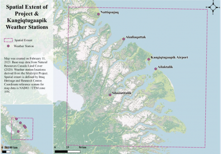
“The community came to us to help them with their efforts for self determination on a project organized and led by the Nunavut-based Ittaq Heritage and Research Centre. The centre had installed five weather stations across their lands on Baffin Island to collect data on the environment but they were having issues being able to present the information and use it more readily in day-to-day decision-making.”
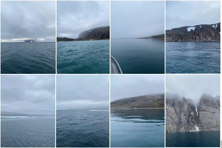
The ability to easily access real-time weather updates is critical to Inuit hunters.
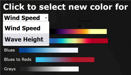
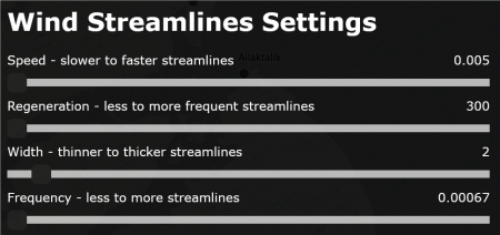
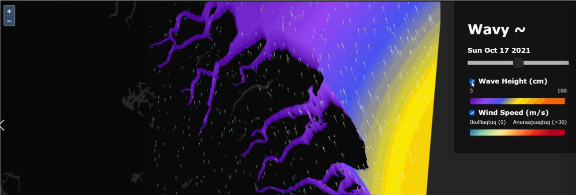
This issue led to Conzon’s research which was encapsulated in her thesis titled, Towards Co-Production of a Geographic Information System to Support Mobilizing Inuit Knowledge for Community-Led Land-Based and Guardian Programs: A Case with Clyde River Inuit Hunters in Nunavut, Canada. Conzon was able to collaboratively design and develop a custom, interactive GIS called “Wavy” (one prototype pictured below) to visualize human-relevant environmental variables—specifically winds and wave heights to ease the access to reliable local weather information in Clyde River, Nunavut.
Conzon gained programming experience while working for the federal government in building dashboards and data processing pipelines. These technical skills came in handy as she worked on developing different ways of presenting the information easiest to interpret for the Inuit hunters.
Having successfully defended her thesis and earned her master’s, Conzon is currently working in Kelowna, B.C. as a Geographic Information System program manager with The Firelight Group —an Indigenous-owned consulting group that works with Indigenous communities to provide policy, planning, mapping, negotiation and advisory services.
In addition to leading a team of mappers, she is continuing to monitor her thesis project to make sure that it gets to a viable state for use by Clyde River Inuit Hunters.
Immersion into the Environment Was Key to Success
Conzon says she had to rethink the position of a researcher relative to working with Indigenous communities.
“I’m someone who wants to get things done and I think it was important for me to recognize the importance of patience. From the design of the research all the way to the end results were influenced by our Indigenous partners. They advised how to recruit participants and even led the recruitment and every kind of method I applied. I discussed and confirmed that they felt comfortable with my methods and refined things where needed,” says Conzon.
“I think it’s really important as a developer and programmer producing these types of tools that you have to immerse yourself in these communities to understand how to make a usable and useful digital product.”